AFTER THE HEAT, A NEW THREAT ARRIVED
Millions of Americans Face Flash Flood Risks Following Record-Breaking Heat Wave and Severe Storms Over Independence Day Weekend
Millions of Americans are now facing a completely different kind of danger as severe storms sweep across multiple states. The holiday weekend ended, but the warnings haven’t.
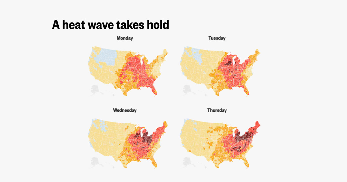
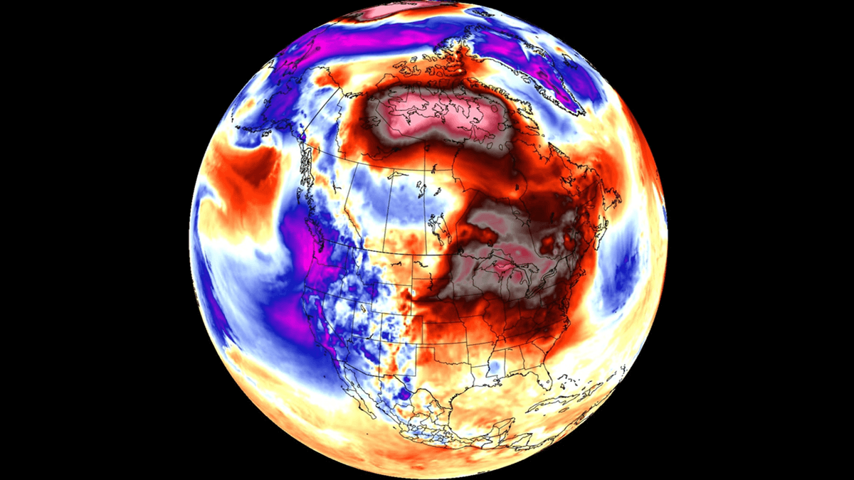
As the United States celebrated its 250th Independence Day in 2026, extreme weather delivered a one-two punch that turned festivities into a fight for safety and recovery. A historic heat dome scorched large swaths of the country with life-threatening temperatures, only to be followed by powerful thunderstorms that triggered flash flooding, damaging winds, and widespread power outages. According to reports from CBS News, AP, CNN, and the National Weather Service, tens of millions faced heightened risks, with recovery efforts still underway in many areas as of July 6-8.
The Scorching Prelude: A Record Heat Wave
The holiday weekend began under the grip of an intense heat dome that blanketed the Midwest, Northeast, and parts of the East Coast. Heat index values soared past 100°F (38°C) for several consecutive days, with some areas experiencing feels-like temperatures in the triple digits. Over 140-200 million Americans were under various heat alerts at the peak, making it one of the most widespread and dangerous heat events in recent memory.
Cities from Philadelphia and New York to Chicago and beyond sweltered. Parades and outdoor events were canceled or delayed in places like Washington, D.C. Experts noted that such extreme heat on Independence Day is becoming more common, linked to broader climate patterns. Nighttime temperatures offered little relief, exacerbating risks for vulnerable populations, including the elderly and those without air conditioning.
In New Jersey alone, health officials reported suspected heat-related deaths. The combination of high humidity and prolonged heat strained power grids even before the storms arrived, setting the stage for compounded disasters.
The Stormy Transition: Severe Weather Strikes
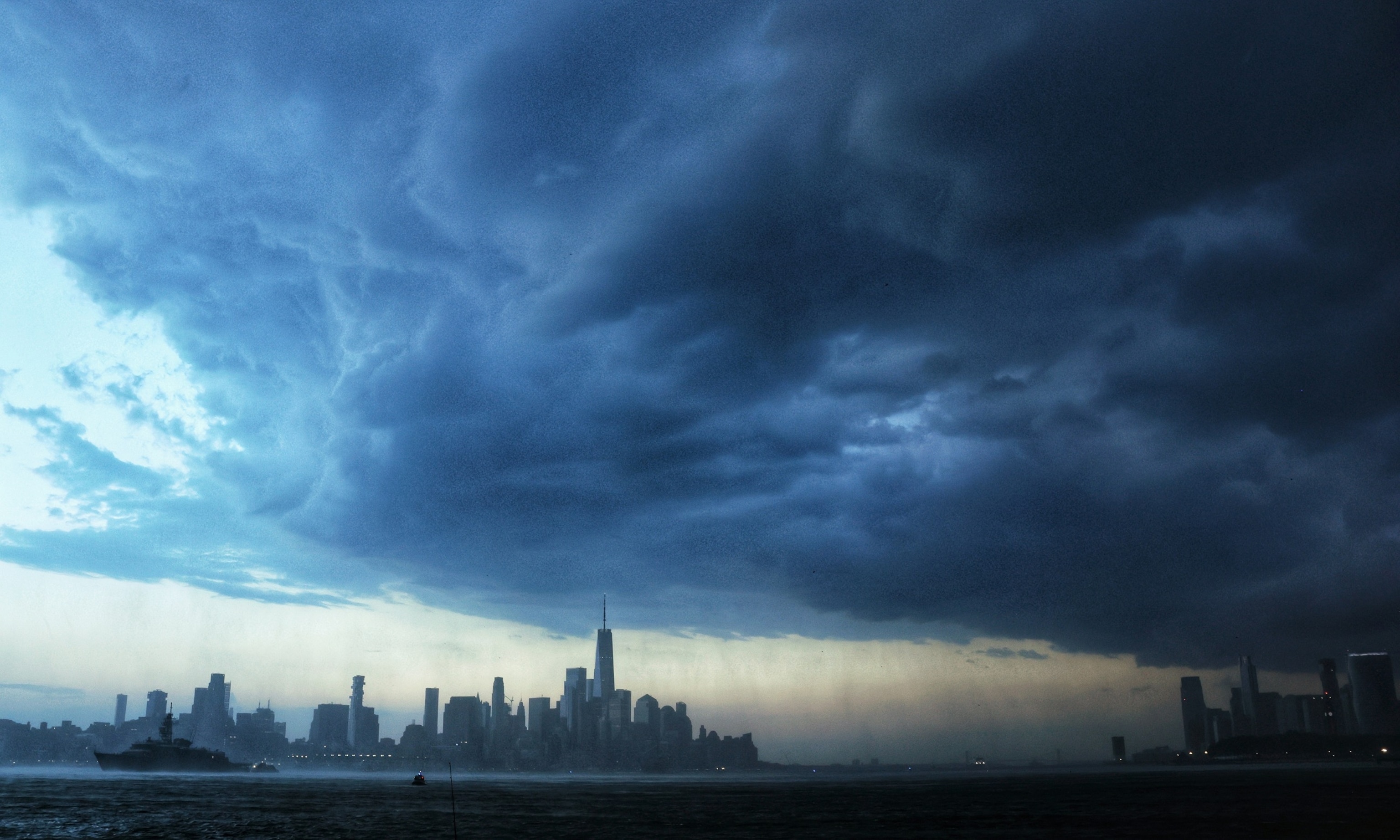
As the heat dome began to weaken, it fueled unstable atmospheric conditions that spawned multiple rounds of severe thunderstorms. From July 2 to July 4, northern Illinois, Indiana, and broader regions across the Plains, Midwest, and Northeast saw four separate waves of storms. Peak wind gusts exceeded 70 mph, downing trees and power lines, while torrential rains led to dangerous flash flooding.
The Storm Prediction Center issued enhanced risks (level 3/5) for severe weather in several areas, with primary threats including damaging winds, large hail, and isolated tornadoes. However, the biggest hazard for many became excessive rainfall on already saturated or heat-hardened ground. Slow-moving storms dumped several inches of rain in short periods, overwhelming urban drainage systems and low-lying areas.


Flash flood watches covered tens of millions, with specific alerts for the Northeast extending through early in the week. In parts of Pennsylvania, New Jersey, New York, and the Midwest, rivers and streams rose rapidly. Reports emerged of flooded roads, stranded vehicles, and rescues. The National Weather Service emphasized that urban and low-lying areas faced the greatest risk.
Widespread Power Outages and Recovery Challenges
The storms left a trail of destruction on infrastructure. As of early July 6-8, hundreds of thousands of utility customers remained without power, with peaks exceeding 500,000-1 million across affected states. Pennsylvania and Michigan were among the hardest hit, alongside New Jersey, New York, and others. Utility crews from across the country, including from Canada, mobilized for restoration.

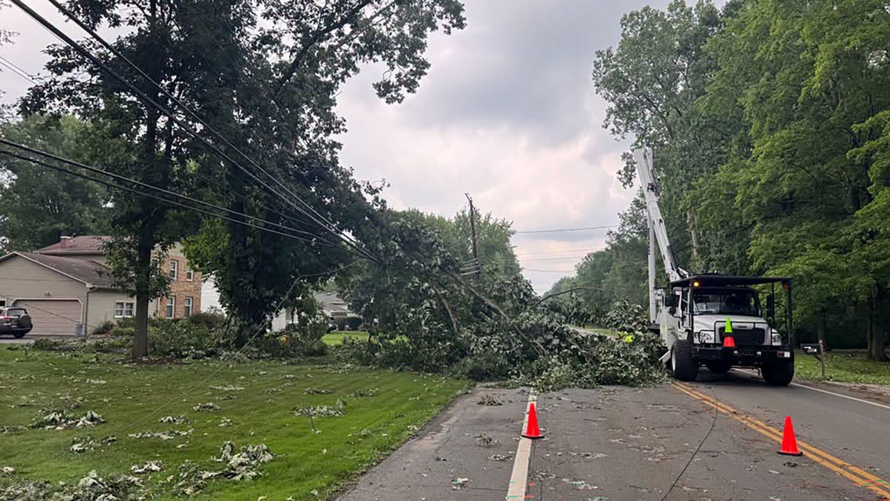
Power outages compounded the misery in the lingering heat. Without air conditioning, residents faced heightened heat-related health risks. Some utilities offered credits for spoiled food, but the broader economic and safety impacts were significant. Tree damage and downed lines snarled traffic and delayed repairs.
Human Impact and Community Response
Beyond statistics, the events affected everyday lives. Families cut short barbecues and fireworks displays. Emergency services responded to numerous incidents, including water rescues and medical calls. In some areas, officials urged residents to avoid travel and stay informed via weather apps and alerts.
The transition from oppressive heat to flooding highlighted the volatility of summer weather patterns. Meteorologists like those at CNN pointed to the heat dome’s role in energizing the atmosphere, a setup increasingly familiar in a warming climate.
Local governments and the National Weather Service issued repeated warnings. In the Lehigh Valley and other spots, flood watches persisted, with additional storm risks noted into the week. Communities rallied, with neighbors checking on the vulnerable and sharing resources during outages.


Looking Ahead: Lingering Risks and Lessons
As of July 8, some areas continued to see flood threats and storm potential, though the most intense phase had passed. The pattern was shifting, with heat building in the West while the East experienced relief mixed with showers. Forecasters warned that excessive rainfall risks could persist in parts of the central and eastern U.S.
This weekend’s events serve as a stark reminder of the interconnected nature of extreme weather. A heat wave doesn’t just end—it can ignite the next hazard. Officials and experts urge preparedness: emergency kits, weather radios, flood insurance reviews, and awareness of local risks.
For millions still cleaning up or waiting for power, the message is one of resilience. The July 4, 2026, celebrations may have been dampened, but they also underscored the importance of community and vigilance in the face of nature’s power.
Sources include reports from CBS News, CNN, ABC News, National Weather Service, and PowerOutage.us tracking. Images depict storm conditions, heat maps, and impacts from the period.